The C3DMEMO program needs to be configured to work correctly.
In case the program is running in pure AutoCAD, whenever some kind of CADMEMO report is to be executed, it must first interpret the project.
Then we have:
To identify these elements, you need to set up a series of attributed blocks or texts with specific layers.
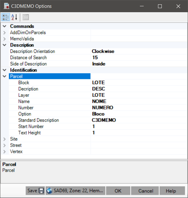
To map these blocks, attributes, and layers, when calling any command, the following screen will appear:
Configure the items in the Identification category and click the  Save button.
So, the next time you use the commands, the screen will already be configured.
Save button.
So, the next time you use the commands, the screen will already be configured.
Then we have for each item (lot, sites, streets and vertices):
Note that the fields related to blocks and attributes are disabled in case the program is running on Civil 3D, since in this, one works with parcels, alignments and CogoPoints.
Tips:
You may not need to use all attributes, so simply select the same attribute for all elements.
The Description attribute can be useful for writing those "generic" texts, for example, "urban parcel" or "permanent preservation area". That is, texts that can not be represented by Name only.