 PT2PT
PT2PT
PT2PT converts Civil 3D, Topograph and Position points
To use the command:
- call it from the command line: PT2PT:
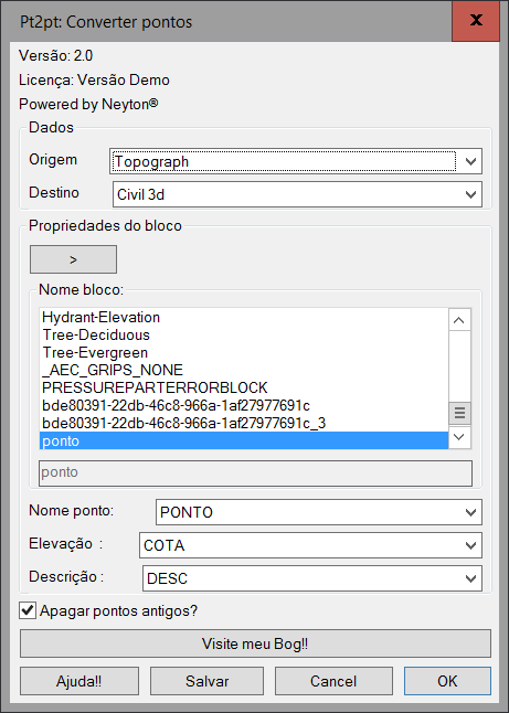
- Enter the origin of the points and the destination
- If the destination is the topograph, you must enter the attributes corresponding to the dimension, name and description. If you do not have the block yet, enter a name in the field below the list
And the program will create a default block
- In the case of the topograph, you must indicate which attributes match the Dimension, Description and Point Name
- Check Delete if you want the source points to be deleted
- Choose whether or not to hold the joint
This program is very simple and any suggestions for improvement will be very welcome !!