 EXPGE2
The command EXPGE2 export drawing objects in AutoCAD to Google Earth, creating a KML file for it
what is selected.
To use the command:
-
Call it from the command line (command EXPGE2 ), on the toolbar, or ribbon
-
Select the objects to export:

-
Choose where to save the resulting KML file
-
Set the items on the screen that opens:

-
Options
-
Closed polylines are "Polygons" - when checked, all lines that form a closed area are exported
like "polygon" in KML.
This allows this area to be filled later with a hatch.
If this option
is cleared, the closed line will be exported as "path" in the KML, that is, a simple line that can not be exported.
-
Open Google Earth on finish After KML is created, it will be automatically uploaded to Google Earth, if this option is checked.
-
Export freeze or off layers - The EXPGE2M command exports batch dwg files.
It exports all the contents of the Model Space from the file.
Use this option to decide whether frozen or
off layers should be exported as well.
-
Explode Hatches - When exporting AutoCAD hatches, they can be exported as "Polygon" with fill
solid, or can be exported while maintaining texture.
If used, for example, "HEX" or "LINE" type
produced a series of elements of the type line to imitate the hatch in Google Earth.
This generates much larger KML files.
-
Treat xREF layers - When exporting elements that are in xREF, the layer names contain the character "|".
With this option, the filename becomes a folder in KML and the name of the layer is a subfolder of it.
-
Visible Folders - Blocks are a collection of objects in KML.
These objects are grouped into elements that can be of type MultiGeometry or
Folder.
If it is MultiGeometry, you will not have direct access to the element.
If
Folder, just open the folder to cease the element.
-
Expanded Folders - Folders and subfolders displayed on Google Earth can
already be expanding, or not.
Use this option to decide.
-
Export block as MarkedPoint - You can choose to export the block as
MarkedPoint (pin) or export the geometry of the block as it is.
If this option is checked, you can arbitrate the attributes of the block from which
to read the name and the description of the pin.
The remaining attributes will be listed in the pin description.
-
Coordinates
-
UTM - Reads object coordinates in UTM, where it is coincident
with the AutoCAD WCS
-
Geographic - Read the coordinates of objects in geographical
coordinates, where it is coincident with the AutoCAD WCS
-
Elevations - Sets should be treated as the elevations of coordinates read from AutoCAD to export to Google Earth
They can be:
-
In soil - The elevation is ignored, assuming the value attributed to the land by the Google Earth that position
-
Relative to the ground - the value of share dealing, will be
assigned as the height above the ground at that point elevation
-
Absolute - This is the real position of the point
-
Description - Available for editing in the licensed version of the program.
-
Reference
Select the reference to be used to convert the coordinates in UTM and Geographic coordinates to convert the system
coordinates to WGS84, which is the reference used in Google Earth.
In Brazil, normally AutoCAD drawings are
georeferenced system SAD69 or SIRGAS 2000.
You can edit the values clicking:

On the screen that opens, set the reference options:

It is very important to read the above screen explanation
-
Click OK
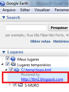
The KML file is created and opened in Google Earth:

Comments
-
Layers of AutoCAD objects are treated as "Folders" on Google Earth and each object is identified within this "Folder".
-
All AutoCAD lines are treated as Path or Polygon
-
The texts will be treated as Marker
-
Blocks are treated as a collection of objects within a folder.