To obtain latitude/longitude or UTM coordinates, must be configured the coordinate system, to do this, use the command GEOGRAPHICLOCATION.
For converted coordinates to Latitude, Longitude and UTM, it must set the coordinate system. For this, use the GEOGRAPHICLOCATION. By calling this command, you should choose the Map , then the following screen will open:
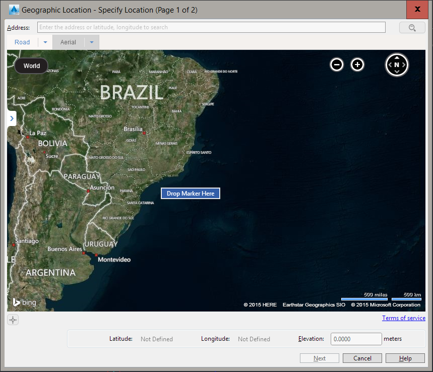
On this screen, right-click on the approximate location of your project and click the Drop Marker Here that appears. Click the Next and choose your reference:
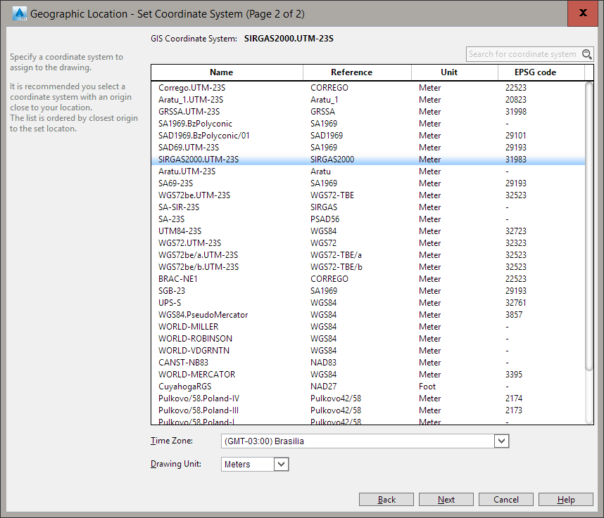
Select SIRGAS2000. UTM23-S and click the Next. At the command line, click its reference point in local coordinates. This point should be georeferenced. Also tell which is the northern orientation on the local system. Ready !!! Now, if you use AutoCAD 2014 or higher, you can even see the satellite image of Bing, using the GEOMAP
Note that you have to log in to your Autodesk account 360:
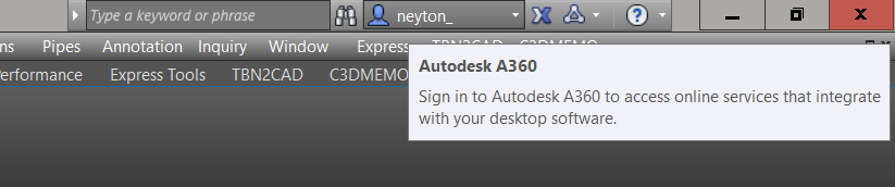
You may need to update your AutoCAD if the command GEOMAP does not show anything. Look on the Autodesk site which latest service pack available and update.
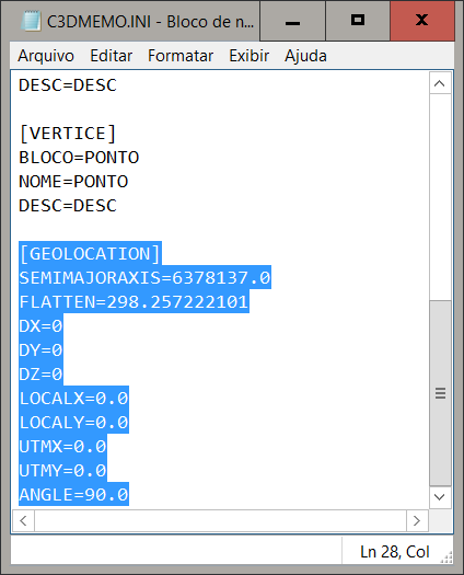
Is necessary define parameters in C3DMEMO.ini on program folder: